SoCal earthquake: 5.4-magnitude earthquake hits Searles Valley, 1 day after 6.4 temblor


RIDGECREST, Calif. -- A magnitude 5.4 earthquake hit near Searles Valley Friday morning, one day after a powerful 6.4 quake hit the region.
The quake is one in a series of aftershocks to hit the area since Thursday's 6.4 earthquake. It struck at approximately 4:07 a.m. local time and was centered about 9.7 miles from west of Searles Valley and 10.8 miles north-northeast of Ridgecrest, according to the U.S. Geological Survey.
RELATED: 6.4 temblor, strongest in Southern California in 20 years, strikes Mojave Desert

There were no immediate reports of damage in the surrounding area. People felt the quake in various parts of Los Angeles, San Bernardino and Orange counties.
"It was a rumbling sound that first woke us up," Jay Winkel, a Ridgecrest resident, said about the morning aftershock. He added he felt his whole house shake.
About an hour and a half after the 5.4 Friday quake, Los Angeles Fire Department tweeted that it had completed earthquake mode and gone back to normal operations.
At an afternoon press conference, California Institute of Technology seismologists said there have been 1,400 aftershocks since Thursday's powerful quake. They added that there's a 6% chance of a magnitude 6.0 earthquake or larger in the coming days.
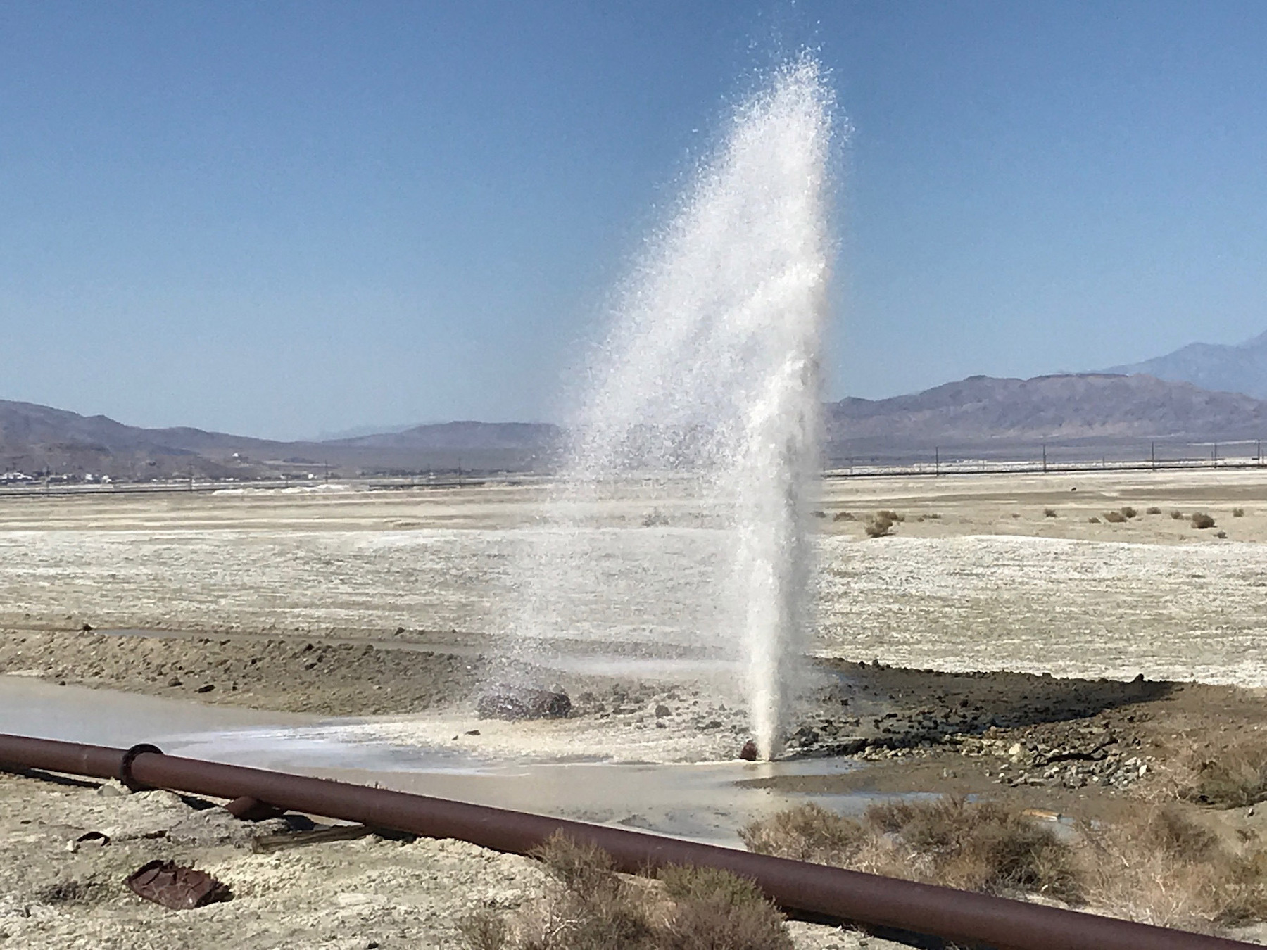
There's a USGS team surveying the landscape. Seismologists said it appears that two faults are involved with the 6.4 quake, which was large enough to break the surface. Most of the rupture happened on the China Lake naval base, where some buildings suffered damage.
Seismologists described what the surface rupture looks like.
"It really looks like a scar across the desert floor. Sometimes an earthquake like this moves the ground laterally, so one side goes sideways relative to the other. In the desert it's hard to see because you're just offsetting sand and tumbleweeds, but you can see the cracks that have a little bit of opening to them," said seismologist Susan Hough.
Seismologists also said the damage in Ridgecrest could have been much worse if it was an older community. Ridgecrest started in the 1940s, which was after California had seismic provisions in the statewide building code.
Thursday's earthquake was the strongest earthquake in the Southern California region since 1999, with people throughout Southern California reported feeling it. Minor cracks, multiple water mains ruptured and several power lines were down after the quake hit, according to the San Bernardino County Fire Department.
Firefighters in Kern County responded to nearly two dozen incidents including medical emergencies and reports of a burning home.

Kern County Fire Chief David Witt said emergency responders also contended with small vegetation fires, gas leaks and reports of cracked roadways in Ridgecrest, a city with a population of 28,000.
Twenty patients were evacuated from Ridgecrest Regional Hospital as a precaution amid a slew of aftershocks on Thursday.
By Friday, some homes in Ridgecrest were red-tagged. At the Trousdale Estates mobile home park, one home fell off its foundation in Thursday's tremor, in another home, the floor collapsed.
About a mile away, another home was boarded up after the garage was destroyed by a fire believed to be triggered by the quake.
Despite the moderate damage, many residents were happy that the quake didn't cause more serious problems.
PHOTOS: July 2019 Ridgecrest earthquake rocks SoCal


SEE ALSO: Earthquake scale: How they are measured and what the magnitude and intensity scales mean


