Plane effect snow: What creates the rare weather phenomenon


CHICAGO (WLS) -- Snow is nothing new to the Chicago area, but parts of the city did experience a cool weather phenomenon over the weekend.
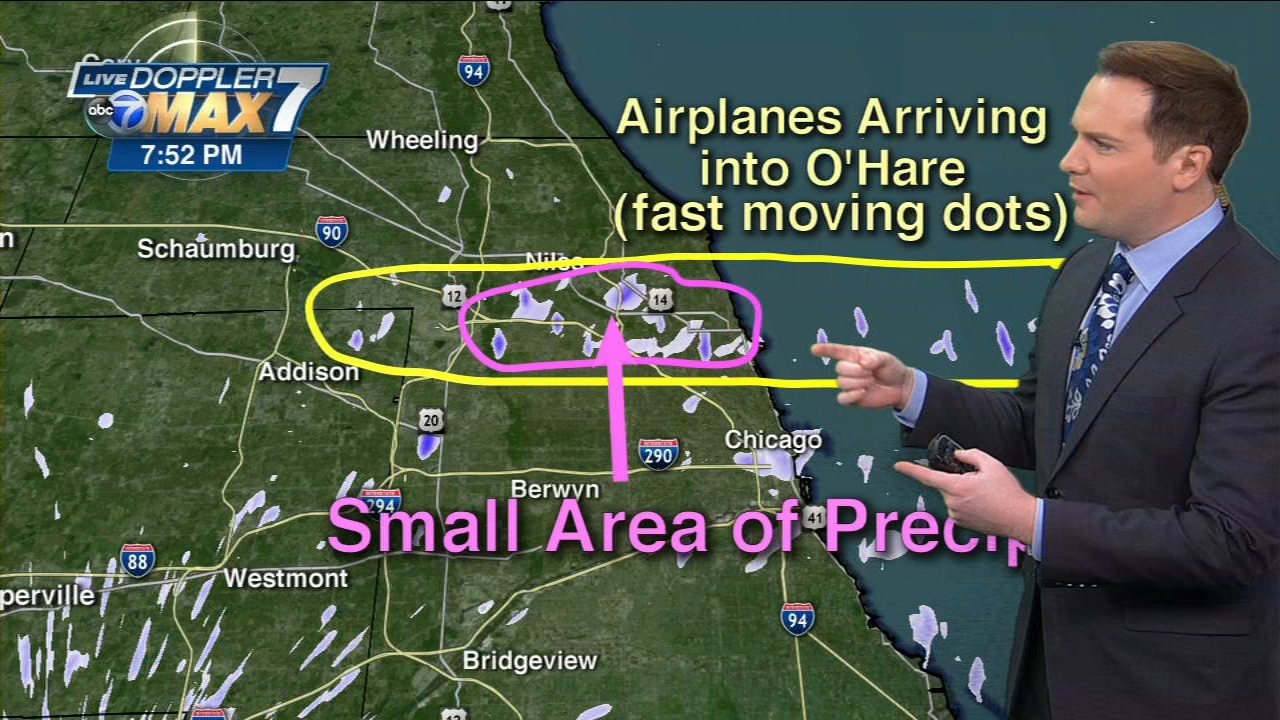
As planes arrived at Chicago's O'Hare and Midway international airports, a light precipitation developed in their wake known as airplane effect snow.
ABC 7 Chicago Meteorologist Larry Mowry explained what makes this possible.
Mowry said in an animated loop you can see fast moving tiny little specks, which are the planes being picked up by the radar as they land at O'Hare. In the radar loop, you can also see light precipitation that developed in the landing path.
He said despite temperatures being below freezing, the atmosphere was containing super cooled water droplets that were not quite frozen, making the atmosphere super saturated at the lowest levels. Mowry said this weather event is known as "super cooled raindrops" because they can stay rain even in an environment that is below freezing.
What created the plane effect snow was the aircraft adding "dust" or exhaust into the super cooled environment, allowing those super cooled drops to condense on the "dust" and form a snow flake.

The plane effect snow did not cause any accumulation, but created a rare weather event none the less.