Severe Thunderstorm Watch issued for several Chicago area counties, NWS says | LIVE RADAR
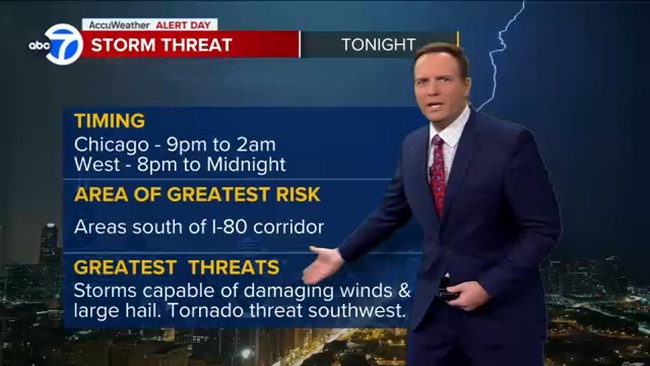
Greatest threats are damaging winds and hail, said ABC7 Chicago Meteorologist Larry Mowry

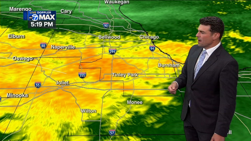
CHICAGO (WLS) -- A few rounds of thunderstorms are expected in the Chicago area late Sunday, ABC7 Chicago Meteorologist Larry Mowry.
A Severe Thunderstorm Watch has been issued for Ford, Grundy, Iroquois, Kankakee, Kendall, LaSalle, Lee, Livingston and Will counties until 4 a.m. Monday, according to the National Weather Service.
A Severe Thunderstorm Warning has also been issued for Cook, DuPage and Kane counties until 11:30 p.m. Sunday.
It has been mostly dry Sunday, but storms will roll through in the evening between 8 p.m. and 2 a.m. Monday.
Organized thunderstorms are expected to develop in eastern Iowa before tracking eastward over portions of northern and central Illinois, the National Weather Service said.
The greatest severe weather risk will be in areas south of the I-80 corridor, Mowry said
The storms will be capable of damaging winds and large hail. Winds could reach up to 70 mph and heavy downpours may also lead to a localized flooding threat, NWS said.
The overall threat of tornadoes in the Chicago area are low but the risk is higher in the southwest, Mowry added.
Warm weather will continue until late Wednesday before cooler temperatures arrive with the weekend.