Chicago weather this week includes snow storm into Wednesday, followed by cold blast

CHICAGO (WLS) -- The Chicago area is expected to see more snow Tuesday into Wednesday, followed by a blast of frigid weather.
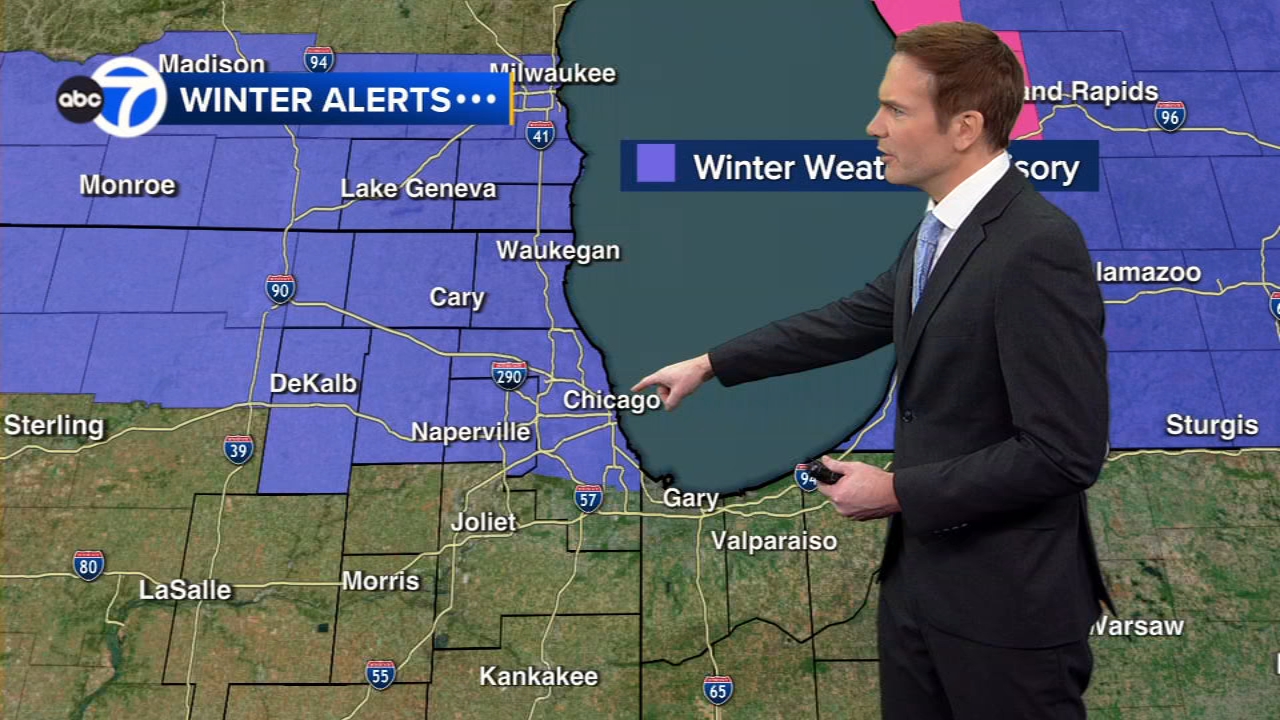
There is a Winter Weather Advisory for Cook, DuPage, Lake, McHenry, DeKalb, Kane and Boone counties in Illinois from 10 p.m. Tuesday until 8 a.m. Wednesday.
ABC7 Chicago is now streaming 24/7. Click here to watch
There is also an advisory from 9 p.m. Tuesday until 6 a.m. Wednesday for Kenosha, Racine and Walworth counties in Wisconsin and from 1 a.m. ET until 10 a.m. ET Wednesday for Berrien County, Michigan.
The highest snowfall amounts are expected near and north of Interstates 88 and 290. Two inches or less are expected farther south.
In the north suburbs, over 4 inches of snow are possible.
SEE ALSO | Full list of warming centers open in Chicago, suburbs
Some of the snow may linger for the Wednesday morning commute, creating some slippery conditions or poor visibility, especially in the early part of the commute, ABC7 Chicago meteorologist Larry Mowry said.
Temperatures Wednesday will be milder, with highs in the upper 20s to near 30. There will be another chance of some scattered snow showers during the evening commute as an Arctic cold front arrives.
Thursday will turn colder, with a high of just 20. But the core of the cold air arrives Thursday night and Friday morning and throughout the day on Friday.
Friday morning windchills could be as cold as 35 below zero.
Friday's high temperature may not get above subzero readings.
Saturday will also be very cold. Below-average temperatures are expected for the rest of the month, Mowry said.