

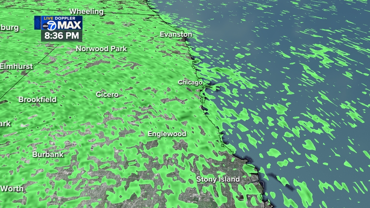
Chicago Area Weather Radar

- Flood Warning
...The Flood Warning continues for the following rivers in Illinois... Illinois River at Ottawa affecting La Salle County. Illinois River at La Salle affecting La Salle, Bureau and Putnam Counties. For the Illinois River (Upper)...including Morris, Ottawa, La Salle...Minor flooding is forecast. * WHAT...Minor flooding is forecast. * WHERE...Illinois River from Heritage Harbor east of Ottawa downstream to Starved Rock Lock and Dam, including the Ottawa gauge. * WHEN...Until early tomorrow afternoon. * IMPACTS...At 462.5 feet, Roadway entrance to Allen Park threatened in Ottawa. Allen Park west boat ramp inundated in Ottawa. * ADDITIONAL DETAILS... - At 8:30 PM CDT Friday the stage was 462.7 feet. - Forecast...The river is expected to rise to a crest of 463.0 feet tomorrow morning. - Flood stage is 463.0 feet. - http://www.weather.gov/safety/floodMore
- Flood Warning
...The Flood Warning continues for the following rivers in Illinois... Illinois River at Ottawa affecting La Salle County. Illinois River at La Salle affecting La Salle, Bureau and Putnam Counties. For the Illinois River (Upper)...including Morris, Ottawa, La Salle...Minor flooding is forecast. * WHAT...Minor flooding is occurring and minor flooding is forecast. * WHERE...Illinois River from Starved Rock Lock and Dam downstream to confluence with Big Bureau Creek, including the La Salle gauge. * WHEN...Until Wednesday morning. * IMPACTS...At 22.0 feet, Lower parking lot at Starved Rock State Park is inundated east of La Salle. High water levels begin to impact shipping interests along the river. * ADDITIONAL DETAILS... - At 8:45 PM CDT Friday the stage was 23.1 feet. - Forecast...The river is expected to rise to a crest of 23.5 feet tomorrow morning. It will then fall below flood stage early Wednesday morning. - Flood stage is 20.0 feet. - http://www.weather.gov/safety/floodMore
- Flood Warning
...The Flood Warning continues for the following rivers in Illinois... Vermilion River near Leonore affecting La Salle County. For the Vermilion River (Illinois Basin)...including Pontiac, Leonore...Minor flooding is forecast. * WHAT...Minor flooding is occurring and minor flooding is forecast. * WHERE...Vermilion River from IL23 near Streator downstream to confluence with the Illinois River, including the Leonore gauge. * WHEN...Until Sunday morning. * ADDITIONAL DETAILS... - At 10:45 AM CDT Friday the stage was 18.7 feet. - Recent Activity...The river climbed above flood stage yesterday and began cresting this morning. - Forecast...The river is expected to remain near 19.0 feet today before slowly falling overnight. - Flood stage is 16.0 feet. - http://www.weather.gov/safety/floodMore
- Flood Warning
...The Flood Warning is extended for the following rivers in Illinois...Indiana... Little Calumet River at Munster (Hohman Avenue) affecting Lake IN and Cook Counties. ...The Flood Warning continues for the following rivers in Illinois... Thorn Creek at Thornton affecting Cook County. For the Little Calumet River...including Munster (Hohman Avenue)... Minor flooding is forecast. * WHAT...Minor flooding is occurring and minor flooding is forecast. * WHERE...Little Calumet River from IN-912 in Hammond downstream to confluence with Thorn Creek in South Holland, including the Munster (Hohman Avenue) gauge. * WHEN...Until just after midnight tonight. * IMPACTS...At 12.5 feet, Most areas outside of the levee-protected area are inundated in Hammond and Munster. * ADDITIONAL DETAILS... - At 10:00 AM CDT Friday the stage was 12.4 feet. - Recent Activity...The river climbed above flood stage overnight and continues a slow climb. - Forecast...The river is expected to crest near 12.5 feet by early this afternoon and then fall below flood stage overnight into tomorrow. - Flood stage is 12.0 feet. - http://www.weather.gov/safety/floodMore
- Flood Warning
...The National Weather Service in Chicago IL has issued a Flood Warning for the following rivers in Indiana... Kankakee River at Shelby affecting Newton and Lake IN Counties. For the Kankakee River...including Shelby...Minor flooding is forecast. * WHAT...Minor flooding is forecast. * WHERE...Kankakee River from Near I-65 and De Motte downstream to IL/IN state line, including the Shelby gauge. * WHEN...Until early Sunday morning. * IMPACTS...At 10.5 feet, Water overflows low-lying river banks along Bluegrass Road east of Sumava Resorts and along Westwood Drive and Island Boulevard near Shelby. Water begins to be diverted through the Blackberry Marsh Spillway to reduce flood impacts. * ADDITIONAL DETAILS... - At 5:45 PM CDT Friday the stage was 10.5 feet. - Recent Activity...The river has continued a slow climb today. - Forecast...The river is expected to crest near flood stage tonight. - Flood stage is 10.5 feet. - http://www.weather.gov/safety/floodMore
- Flood Warning
...The Flood Warning is extended for the following rivers in Illinois...Indiana... Little Calumet River at Munster (Hohman Avenue) affecting Lake IN and Cook Counties. ...The Flood Warning continues for the following rivers in Illinois... Thorn Creek at Thornton affecting Cook County. For the Little Calumet River...including Munster (Hohman Avenue)... Minor flooding is forecast. * WHAT...Minor flooding is occurring and minor flooding is forecast. * WHERE...Little Calumet River from IN-912 in Hammond downstream to confluence with Thorn Creek in South Holland, including the Munster (Hohman Avenue) gauge. * WHEN...Until just after midnight tonight. * IMPACTS...At 12.5 feet, Most areas outside of the levee-protected area are inundated in Hammond and Munster. * ADDITIONAL DETAILS... - At 10:00 AM CDT Friday the stage was 12.4 feet. - Recent Activity...The river climbed above flood stage overnight and continues a slow climb. - Forecast...The river is expected to crest near 12.5 feet by early this afternoon and then fall below flood stage overnight into tomorrow. - Flood stage is 12.0 feet. - http://www.weather.gov/safety/floodMore


