Chicago weather: Lake-effect snow could make for messy commutes Friday


CHICAGO (WLS) -- ABC7 meteorologists are keeping an eye on the next round of lake-effect snow forecast to impact parts of the Friday morning and afternoon commutes.
ABC7 Chicago is now streaming 24/7. Click here to watch
A Winter Weather Advisory will take effect for Cook, DuPage, Lake counties starting 9 a.m. Friday until 3 p.m. Friday.
A Winter Storm Watch will take effect for central and southern Cook County starting 3 p.m. Friday until 12 a.m. Saturday.
A Winter Storm Warning will take effect for Porter County and Lake County, Indiana starting 3 p.m. Friday until 6 p.m. Saturday.
Meteorologists said the incoming system will have a scattered impact across the area on Friday.
Starting at 5 a.m. a band of snow will begin to set up to over Lake Michigan.
By 9 a.m. north-northeast winds are forecast to push the system over the Chicago area.
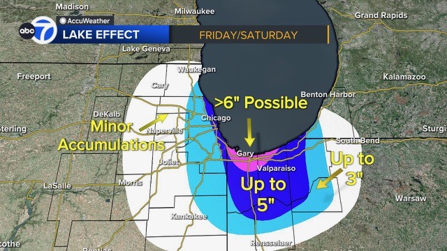
Total snow accumulations could range between 2 and 6 inches, areas near Lake Michigan will likely have more.
The band of snow will then make its way over to Northwest Indiana.
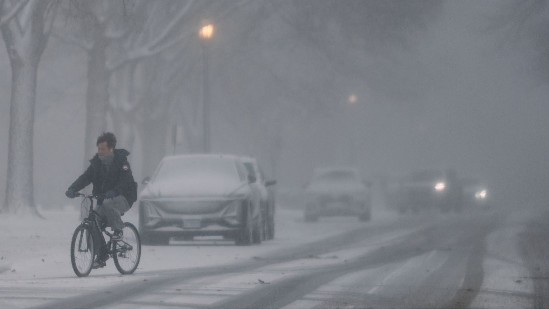
The city warned of slick travel conditions on Friday and Saturday morning.
As for weekend temperatures, Saturday kicks off a "less cold " trend with highs in the mid-20s.
Meanwhile, a potential blizzard is headed to the Southeast this weekend, impacting the Carolinas, Georgia, Virginia and Tennessee.
Some areas could even near 1 foot of snow, especially along the North Carolina coast where the heavy snow may last longer.
READ ALSO | Potential blizzard headed to Southeast this weekend