Severe weather spurs alerts across Chicago area; more storms expected Wednesday | Radar
A ground stop is in place at O'Hare airport until about 11:45 p.m.


CHICAGO (WLS) -- Multiple rounds of storms are expected to move through the Chicago area Tuesday into Wednesday.
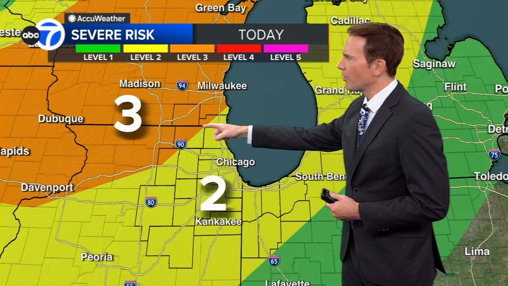
Most of the Chicago area is under a Level 3 Risk for severe storms.
ABC7 Chicago is now streaming 24/7. Click here to watch
Hail and wind are the primary threat from the severe storms, with a risk for tornadoes, as well.
A Severe Thunderstorm Warning is in effect for Cook and DuPage counties until 11:15 p.m.
A Tornado Watch is in effect for Cook, DuPage and Lake (Illinois) counties until midnight Wednesday.
A Tornado Watch is in effect for La Porte County until 3 a.m. Wednesday.
A Flash Flood Warning is in effect for Cook and DuPage counties until 3:45 a.m. Wednesday.
A Flood Warning is in effect until 4:45 a.m. Wednesday for Kane, Lake and McHenry counties in Illinois.
A Flood Watch is in effect until 6 a.m. Wednesday for much of the Chicago area.
A ground stop is in place at O'Hare airport until about 11:45 p.m.
There are delays of about 30 minutes at O'Hare, and 62 flights were canceled as of about 11 p.m.
There were tornado warnings in southern Wisconsin that have since expired.
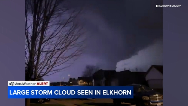
A strong line of storms moved into the far northwest suburbs at a bout 9 p.m. In Elkhorn, a dark storm cloud could be seen.
In Crystal Lake, there was moderate rain. In Huntley, there was a large amount of lightning.
North on Route 47, the rain came down hard, heading into Woodstock. It slowed motorists down.
Water was pooling on the street, but there wasn't much traffic late Tuesday.
Morning storms rolled through the area and cleared out mid-morning Tuesday.
There is also a risk of severe weather Wednesday. The city and Chicago's north and west suburbs are under a Level 2 risk. The south suburbs and northwest Indiana are a Level 1.
The risk Wednesday is also in the afternoon and evening, but it's more of a wind concern, rather than a tornado threat.