Chicago weather: Strong storms, possible tornadoes leave damage across area
Residents on the Des Plaines River are bracing for flooding as more rain moves into the area


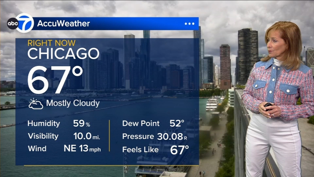
CHICAGO (WLS) -- After a foggy start Friday, severe storms were in the forecast for Friday evening across the Chicago area. The weather warmed up in the afternoon while staying dry before storms arrive in the evening.
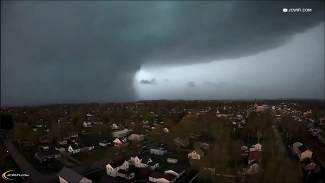
Multiple Tornado Warnings and Severe Thunderstorm Warnings were issued across the Chicago area Friday night, including the city, suburbs, Southwest Wisconsin and Northwest Indiana, between 7:30 p.m. and 11:45 p.m. They have since expired.
Flash Flood Warnings were issued across the area Friday night, lasting until early Saturday
ABC7 Chicago is now streaming 24/7. Click here to watch
ABC7 AccuWeather meteorologists said a line of potentially severe storms started moving into the far western suburbs between 5-7 p.m., bringing heavy rain and strong winds. It then moved into the city closer to 9 p.m.
The Storm Prediction Center had most of the Chicago area at a Level 3 Risk for severe weather except for Northwest Indiana, which was under a Level 2 Risk.
Tornado damage was reported in Lena, Illinois.
"I've been briefed about the tornado damage in Lena and the ongoing warnings throughout the state tonight," Governor JB Pritzker said in a statement. "IEMA is on the ground and in communication with officials to offer our full support. Please follow any local guidance and stay safe."
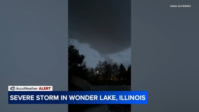
A strong storm was caught on camera in Wonder Lake, Illinois
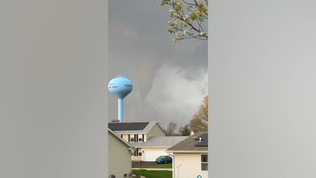
An apparent funnel cloud was visible in Roscoe, Illinois.
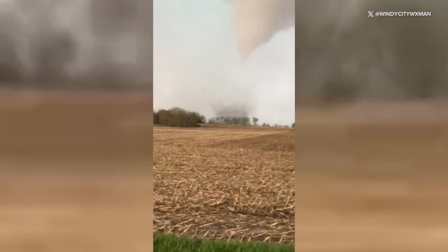
An apparent funnel cloud was also seen in Rockton, Illinois.
The storms caused delays at Chicago's airports.
A Ground Stop for O'Hare airport went into effect at 8:16 p.m. and lasts until 10:45 p.m.
A Ground Delay for O'Hare airport went into effect at 8 p.m. and lasts until 2 a.m. Saturday, the FAA said.
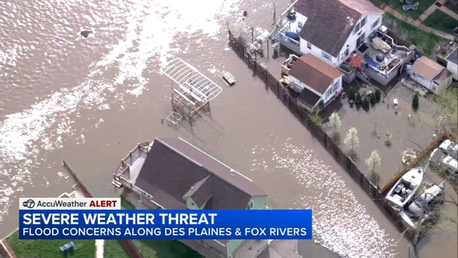
Residents brace for flooding
A Flood Warning is in effect for Cook County until 5:15 a.m. Saturday.
A Flood Warning is in effect for Kane, Kendall, Lake and McHenry counties in Illinois until 5:30 a.m. Saturday.
A Flood Watch is in effect for the Chicago area until 5 a.m. Saturday.
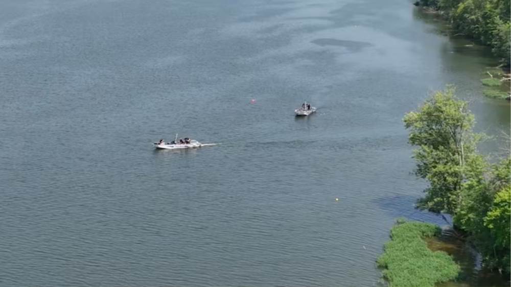
A lot of people in the northwest suburbs have already been dealing with some flooding this week and are bracing for more with promised rain on the way.
Officials have fortified areas prone to flooding as the Des Plaines River continues to swell.
The fire department is monitoring the river's levels, which are now not expected to crest as high as they were originally, but below the major flood stage around 17 feet.
"We're advising everyone to stay out of those flood waters," Des Plaines Fire Battalion Chief Brian Hoffman said. "There can be currents underneath. They've gotta also be washed out manhole covers, which creates hazards of falling into one of those so if they're any flood waters, we advise I'm going to stay out of them."
People who live near the Fox River are also keeping watch. They've already had some flooding, too.
Parts of Chicago weren't spared either. The city said they've gotten hundreds of calls about waterlogged streets and flooded basements.
Forecasters say Illinois is experiencing a very active severe weather season.
"With all the events that we've been happening, people kind of see all this, and they're hopefully not scared by it, but hopefully they'll educate themselves," said Victor Gensini, a meteorology professor at Northern Illinois University. "Hopefully they'll tune in to ABC 7. Hopefully they'll tune into the National Weather Service and get those official watches and warnings and understand when in the forecast this week, do I need to be paying attention? Because there's a likelihood for severe weather, and then know what to do if the watches and warnings are actually issued."
The city's public works department is providing sandbags to anyone who wants them.
After losing a lot of personal items in the last big flood a few years ago, Des Plaines resident Ariana Gomez is keeping her eyes on the skies.
"Like any person whose apartment usually floods, they're always concerned," Gomez said. "We always tend to check in the laundry room because that's where it usually, but everything's been good there."