Chicago ice storm: Over 100K without power as thick coating of ice brings down trees, power lines
ComEd power outages are affecting more than 100,000 customers


CHICAGO (WLS) -- More than 100,000 people in the Chicago area are without power after a winter storm brought heavy rain and ice to the area.
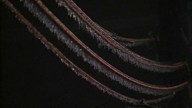
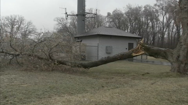
The weight of ice has brought down trees, power lines, blocked streets and made roadways slick and dangerous.
A Winter Weather Advisory has been issued by the National Weather Service for northern Cook, Lake, Kane and DeKalb counties until 6 a.m. Thursday.
An Ice Storm Warning has been issued for McHenry County from until 6 a.m. Thursday.
Parts of southern Wisconsin are under an Ice Storm Warning from until noon Thursday.
CLICK HERE for the latest ABC7 AccuWeather Forecast
ComEd said as of 9:45 p.m., there were 113,000 customers without power, and power had been restored to more than 72,000 customers. Crews are working to restore power to customers as quickly as possible.
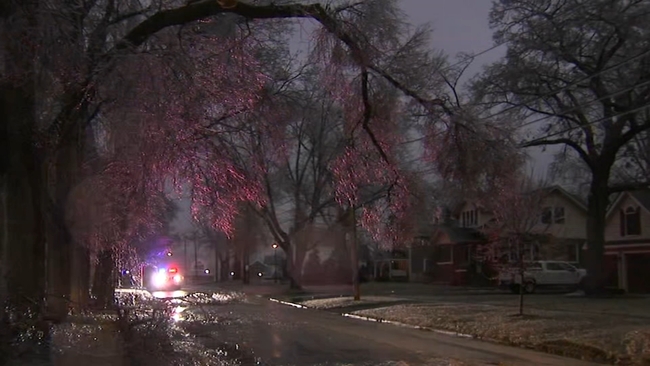
In McHenry County, downed power lines and trees blocking many a darkened street is making getting around even more treacherous for families who haven't only lost power, but heat as well.
"I've got a pizza in the car and we're going to discuss where we are going next," said Elois Kasza of Crystal Lake.
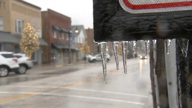
In Lake County, ice has encased tree limbs, power lines, signs and any other freestanding objects. In Lindenhurst, ice downed a tree limb onto a power line. ComEd was on the scene soon after.
In Antioch, the combination of dropping temperatures and rain made for dangerous conditions on the roads. Delilah Hately, on the hunt for a new car, cautiously test drove the vehicle along slick, icy roadways.
"I just took it a bit slower. Just kind of knowing my surroundings making sure that I wasn't going too fast," she said.
On Route I-73 near I-94, just east of Antioch, roads were shut down after a tree fell onto power lines, which spilled onto the roadways.
All across the northern suburbs - in Lake Villa, Lindenhurst, Round lake Heights and more, iced over tree branches came down, onto roads, onto power lines or both.
In Crystal Lake, a huge branch came crashing down, weighed down by the ice buildup from the steady rain all day.
Crews in McHenry County have prepared for the changing conditions. Trucks loaded up on salt Wednesday morning and hit the ground quickly to prepare for the wet weather.
"We're going to get trucks out on the street and we're going to get a light coating of salt down before the temperature drops and then we'll be here throughout the evening to put salt down as needed," public works director Ryan McDillon.
The scene was much the same in Huntley, and in Elgin the cars at one dealership were covered with a layer of ice.
"If you're not sure-footed, you shouldn't go out today," advised Elgin resident Bob Selle.
With the mild winter so far, there is plenty of salt to go around too, so crews will work thru the evening to keep the streets from freezing over.
In Crystal Lake, ground temperatures are still relatively warm, but they began salting roads this morning hoping to get ahead of the storm. It's trickier to deal with weather like today's than a typical snow storm.
"Freezing rain is worse than snow because the rain dissolves the salt so quickly so we have to be out there more often and put down more material," said Crystal Lake Public Works Director Mike Magnuson.
In the northern suburbs, many drivers were concerned about the trek to Wisconsin, with even more snow and ice in the forecast.
"We're not really sure what we're driving into but it sounds like there's going to be a lot of snow and a lot of ice the closer we get to the north, so we're crossing our fingers we don't have to jump off the freeway and get another hotel," said driver Justin Johnson.
Elsewhere in the Chicago area, heavy rain will be likely with 1 to 2 inches possible. The highest totals will be southeast of the I-55 corridor, and you might even hear some rumbles of thunder.
The first round of precipitation started early Wednesday in the south suburbs, and was expected to expand into the western suburbs and city throughout the morning, primarily as rain. Gusty winds are also expected.
Some localized flooding is possible due to heavy downpours. The precipitation will taper off later Wednesday evening and mostly end overnight.
By contrast, in downstate Illinois temperatures are in the 70s with a tornado watch in effect, Mowry said.
Temperatures will warm Wednesday night into Thursday, with temps close to 50 degrees Thursday morning before falling again the afternoon.
Friday will be a cold, blustery day with a high of 28 degrees. A few flurries are possible Friday night.
Stick with ABC7Chicago.com and the ABC7 AccuWeather Team for the latest updates on the winter storm.