13 tornadoes hit greater Chicago area during derecho, NWS says


CHICAGO (WLS) -- Dozens of tornadoes touched down across the greater Chicago area Monday afternoon during a rare severe weather event known as a derecho, the National Weather Service confirmed.
Get the latest weather info with our ABC7 Chicago AccuWeather app
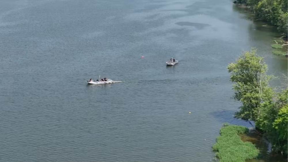
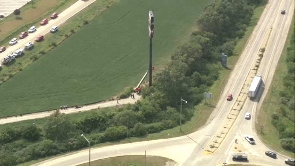
National Weather Service surveyors said they determined a total of 15 tornadoes touched down in northern Illinois and northern Indiana, with 13 of those in the ABC7 viewing area. The derecho also caused widespread straight-line wind damage across the area, downing trees and power lines and leaving more than 800,000 without power.
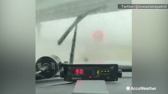
WATCH: Police radar captures 90mph winds during derecho
The first two tornadoes touched down in the Rockford area. As the derecho roared east, 12 more tornadoes touched down in northern Illinois, including Kirkland, Ottawa, Marengo, Elburn, Yorkville/Plainfield, Wheaton, Lombard/Lake Villa, Spring Grove, Oak Forest/Midlothian, Park Forest, Chicago's Rogers Park neighborhood and Grant Park in Kankakee County. One tornado touched down in Newton County, Indiana near Kentland and another touched down in southeast Wisconsin near Lake Geneva.
The biggest outbreak of tornadoes in the greater Chicago area happened on June 30, 2014, when there were 18 tornado touchdowns, which was also the result of a derecho event, ABC7 Meteorologist Cheryl Scott said. The strongest tornadoes in that outbreak were EF-1s.
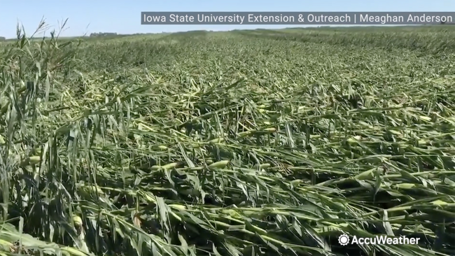
WATCH: Derecho flattens corn field before harvest
Rockford EF-0 tornado
The first was a brief EF-0 tornado on the southwest side of Rockford just after 2:30 p.m., according to NWS. Surveyors determined the tornado traveled 1.5 miles with peak winds of 75 mph. The damage was confined to trees.
Rockford to Caledonia EF-1 tornado
That same supercell produced another EF-1 tornado around 2:47 p.m. that traveled for 9.2 miles from 3 miles northeast of Rockford to 1 mile southwest of Caledonia. The NWS said that the area immediately east of Rock Valley College and west of North Perryville Road sustained significant tree damage.
Kirkland EF-0 tornado
An EF-0 tornado touched down in in Kirkland in De Kalb County at 3:54 p.m. and was on the ground for three minutes, traveling as many miles. Drone footage showed a narrow swatch of corn flattened in a convergent pattern, NWS said.
Ottawa EF-1 tornado
An EF-1 tornado that touched down in Ottawa was only on the ground for three-quarters of a mile, but reached peak winds of 100 mph. The twister ripped well-anchored roofing material off several businesses and snapped a power pole at its base. Eyewitnesses reported the tornado may have had multiple vortices with a clear rising and rotating motion of debris.
Marengo EF-1 tornado
Another EF-1 tornado touched down in southeast Marengo around 3:05 p.m., immediately southwest of I-90 near the McHenry/DeKalb county line, NWS said. The tornado was on the ground for six minutes and traveled 5.7 miles. Tree damage immediately northeast of I-90 was consistent with 95 mph winds. This tornado also heavily damaged a single-family home near Maple Street before heading northeast and lifting near Coral and Dunham Roads.
Elburn EF-1 tornado
Another EF-1 tornado with peak winds of 90 mph touched down in northwest Elburn for two minutes beginning at 3:12 p.m., NWS said. The storm ripped off the gabled roof from a barn and drone footage showed a narrow swath of corn flattened in a convergent pattern.
Yorkville to South Plainfield EF-1 tornado
An EF-1 tornado with peak winds of 105 mph traveled 14.5 miles from the far south side of Yorkville, over the Kendall/Will county line into Plainfield. The NWS said the tornado had a maximum width of 250 yards and caused the most signficant damage east of Schlapp Road along Wheeler Road, where trees were mangled, a farm building was destroyed with debris deposited in a nearby field, and a large grain bin was bent inward. Six power poles were snapped along Ridge Road and a 1,000-1,500 pound auger was moved about 50 feet. The tornado lifted just before I-55, but the storm continued to cause prolific tree damage as it continued into Crest Hill.
Wheaton EF-1 tornado
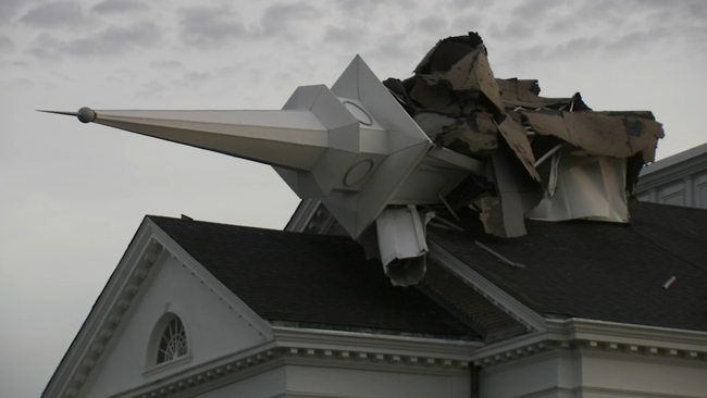
Another EF-1 tornado with peak winds of 90 mph touched down for just over a minute in west suburban Wheaton around 3:35 p.m., NWS said. The tornado's path was just over a quarter-mile and produced damage on the campus of Wheaton College. The storm also knocked over a roughly 50-feet-tall steeple over at College Church.
Lombard/Villa Park EF-1 tornado
That same storm spawned an EF-1 tornado a few minutes later at 3:39 p.m. that traveled a 2.1-mile path from from 1 mile northeast of Lombard to 1 mile northwest of Villa Park, NWS said. The tornado uprooted trees - snapping some at the trunk - and damaged several homes, including some with substantial roof damage.
The worst damage occured near and around the Lombard Common just south of St. Charles Road, the weather service said. The tornado lifted just northeast of Jefferson Middle School.
Lake Geneva EF-0 tornado
The National Weather Service office in Milwaukee confirmed an EF-0 tornado with 80 mph winds touched down at 3:38 p.m., traveling a path of 3.3 miles from Lake Geneva to Walworth over four minutes.
Spring Grove to Camp Lake, Wis. EF-1 tornado
Another EF-1 with winds up to 90 mph touched down around 3:41 p.m. near Spring Grove, Illinois and traveled 3.75 miles over state lines to Kenosha County in Wisconsin, NWS said.
Oak Forest/Midlothian EF-1 tornado
A tornado touched down east of South Harlem Avenue in Oak Forest around 3:57 p.m. then moved 4.9 miles due east along 151st Street before lifting near the I-57/I-294 interchange in Midlothian, NWS said. The storm packed winds up to 100 mph, downing several large trees and snapping power poles at their bases between Cicero Avenue and Pulaski Road. The storm then transitioned to 90 mph straight-line winds as it ripped through Harvey.
Park Forest EF-0 tornado
A brief tornado EF-0 tornado touched down close to the Cook/Will county line around 3:57 p.m., traveling 2 miles northeast, NWS said. The worst damage was confined to a small area near Marquette and Somonauk parks. The tornado lifted over Schuberts woods Forest Preserve then continued to cause straight-line wind damage as it continued east of South Chicago Heights.
Chicago EF-1 tornado

A rare tornado that touched down in Chicago was the final twister spawned by the rare weather event known as a derecho before it moved over Lake Michigan.
The weather service classified the storm as a "high-end" EF-1 tornado after surveying damage on Chicago's North Side. Estimated peak winds reached 110 mph. The tornado was as wide as three football fields and left a path of damage three miles long.
The most intense damage occurred approximately one mile from the lakefront, as well as near and within Phillip Rogers Park, NWS said.
The weather service said the tornado initially touched down south of the intersection of Crawford and Touhy Avenues in suburban Lincolnwood, before moving northeast over the West Ridge and Rogers Park neighborhoods. The tornado moved offshore over Lake Michigan and became a waterspout near the Jarvis and Fargo beaches.
Kentland, Ind. EF-0 tornado
A EF-0 tornado was on the ground around 4:15 p.m. for less than 1 minute north of Kentland in Newton County, NWS said. The tornado produced minor damage to a metal farm building immediately west of State Highway 41.
To meet the criteria of a derecho, the weather event must travel upwards of about 250 miles. However, the storm that descended on the Midwest Monday traveled more than 600 miles, ABC7 meteorologist Cheryl Scott said.