Chicago weather: Snow to fall during PM commute; northern suburbs could see up to 6 inches
Worst travel conditions expected as heaviest snow falls from 6 p.m. to midnight


CHICAGO (WLS) -- A winter storm is approaching the Chicago area and expected to make for sloppy travel across the Chicago area Thursday afternoon and evening.
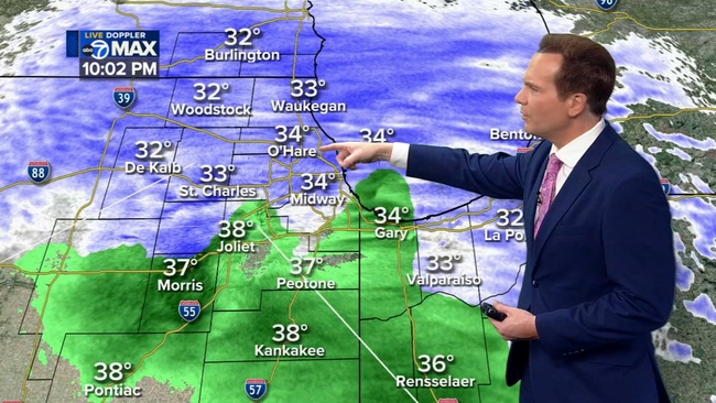
A slushy 1 to 3 inches of snow is possible across most of the area, but parts of Lake and McHenry counties could see between 4 and 7 inches, ABC7 meteorologist Larry Mowry said.
The National Weather Service has issued a Winter Storm Watch for Boone, Central and Northern Cook, DeKalb, DuPage, Kane, Lee, Ogle, Lake, Winnebago and McHenry counties in Illinois from 1 p.m. Thursday to 10 a.m. Friday.
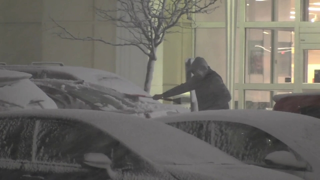
Snow started falling in the northern suburbs a little after 4 p.m. just in time for the evening rush. It started as thick, wet flakes, hampering visibility for drivers but melting as it hit the ground.
A Winter Weather Advisory has also been issued for Boone, DeKalb, Kane, Lee, McHenry, Ogle and Winnebago counties from 3 p.m. Thursday to 7 a.m. Friday.
A Winter Weather Advisory for Northern Cook, Central Cook, DuPage and Lake counties is from 6 p.m. Thursday until 7 a.m. Friday.
The Winter Weather Advisory is in effect for Eastern St. Joseph, Elkhart, Northern La Porte and Western St. Joseph counties in Indiana from 6 p.m. Thursday until 9 a.m. EST on Friday.
In Wisconsin, Kenosha, Milwaukee, Ozaukee, Racine and Sheboygan counties are under a Winter Storm Warning from 6 p.m. Thursday until 10 a.m. Friday.
With temperatures hovering between 30 to 36 degrees overnight and relatively warm road temps, snow accumulation on roadways could be delayed for many hours after the precipitation begins falling.
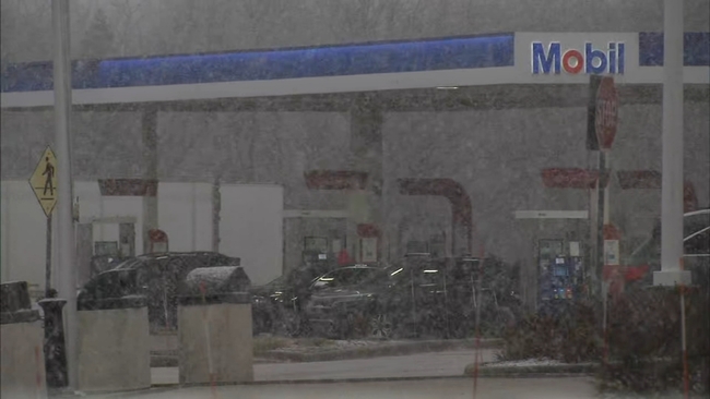
It was a wet, sloppy ride in much of the north and northwest suburbs Thursday night.
"As long as you don't switch lanes, it's been pretty, pretty solid, just wet. But as soon as you hit the slush, it's a little slippery," said driver Joe Principi.
The thick, wet flakes intensified as night fell, catching some drivers off guard.
Public works departments have planned to attack the storm in waves, first Thursday night and then in the early morning hours before people hit the road for their morning commute. They're keeping a close eye on the surface temperature; if it drops below 30 degrees they may have to upgrade their response because of icy conditions.
"If the temperatures drops, and we get the precip, it's going to turn into all snow. And if the pavement drops, the pavement temperature drops, then it's all hands on deck," said Clarence Johnson, superintendent of the North Chicago Public Works Department.
"We pre-salt and already prep before the storm actually hits, so we're prepared for it, so it doesn't get too bad," said Rob Freeman, foreman at the North Chicago Public Works Department.
Light snow showers may linger Friday morning, but will be light and are not expected to cause major issues for the morning commute.
CLICK HERE for the latest ABC7 AccuWeather Forecast
As temperatures drop Thursday into Friday, the rain will transition over to heavy, wet snow for most.
There could be another burst of snow Saturday night into Sunday, which could bring some minor accumulations.
Stay tuned to ABC7 Eyewitness News and ABC7Chicago.com for the latest updates as the winter storm approaches.