Chicago weather: Strong storms bring high winds, heavy rain to parts of area | LIVE Radar
More rain possible Wednesday


CHICAGO (WLS) -- A line of storms brought high winds and heavy rain to parts of the Chicago area on Tuesday night.
Most of the storms started to move out of the area by 10 p.m., but the system stirred up funnel clouds in communities west of the city.
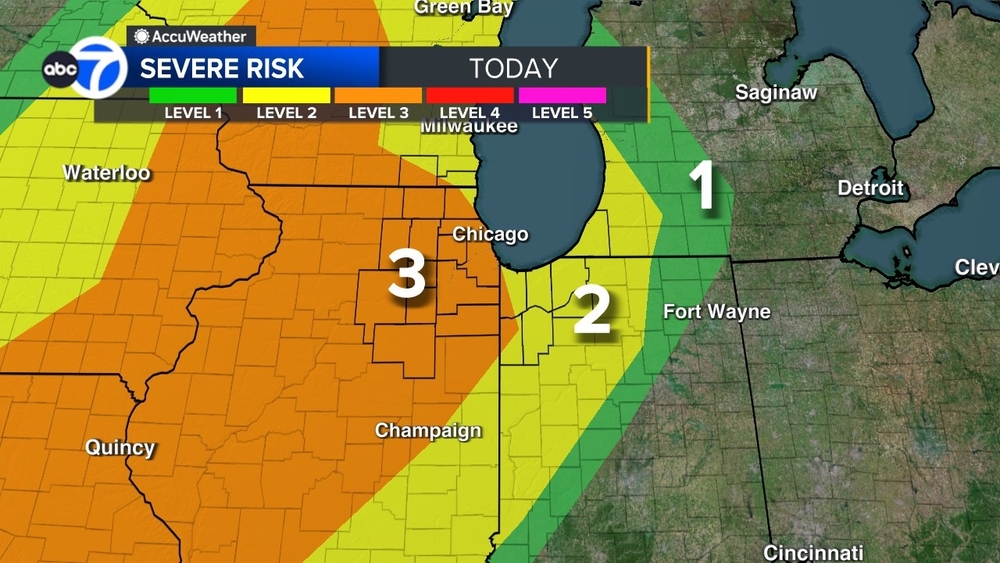
Western counties have a 5% risk of tornadoes Tuesday evening, and Chicago and east of the city have a 2% risk. The Quad Cities and parts of Missouri have a 10% risk. Parts of western Illinois are under an enhanced risk for severe weather Tuesday.
ABC7 Chicago is now streaming 24/7. Click here to watch
ABC7 Chicago Meteorologist Cheryl Scott said some stronger storms were moving toward DeKalb right around Interstate 88 around 10:30 p.m. Scott said the storms, which are expected to bring hail, downpours and lightning, will continue to move northeast through the night.
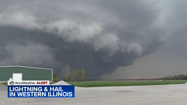
ABC7 Chicago Meteorologist Larry Mowry said the most intense thunderstorms earlier Tuesday were initially located from the Quad Cities down toward Burlington and farther to the south around 6 p.m. But that cluster of thunderstorms moved northeast, toward the Chicago area's western counties, bringing high winds and heavy rain to parts of the area.
Mowry was also watching a cluster of thunderstorms around Pontiac, lifting to the north at about 60 mph around 6 p.m. He said that storm, which was moving up to the Downers Grove area, could prompt a warning for hail.
A Tornado Watch was in effect for Boone, DeKalb and LaSalle counties, but it expired at 10 p.m.
Meanwhile, Chicago started to see some light rain around 6 p.m. with some lightning strikes popping up around the Indiana border, Mowry said.
Additional showers and thunderstorms were expected to flare up in and around the city later in the evening, posing high wind and large hail threats.
ABC7 Chicago Meteorologist Cheryl Scott said the severe threats are expected to diminish overnight with those storms expected taper off by around midnight.
But Scott is also tracking a line of showers and storms out of Iowa that could make its way into the Chicago area, mostly west, on Wednesday morning. Additional storms are also possible in Northwest Indiana.
See the latest AccuWeather report
Tuesday night's Chicago White Sox and Kansas City Royals game has been postponed due to the rain.
The game will be made up as part of a straight doubleheader on Wednesday starting at 1:10 p.m. The second game will begin approximately 30-45 minutes following the conclusion of the opener.